
UAV Aerial Mapping | Geospatial | Photography
WaterVation offers full-service aerial data collection and is supported by our geospatial and engineering teams. Our pilots are fully FAA certified for commercial UAV (FAA 107) operations and support a number of different projects and data applications. From traditional RBG photogrammetry to LIDAR and hyperspectral imaging, our team will supply your project with the data you need.
Below you will find sample deliverables from our past projects. Please feel free to reach out with any questions - our team is here to help incorporate UAV data collection into your next project.
Assessment
Our aerial data provides clients with a digital and geospatially accurate model of their job site. This model is used to derive products such as survey-grade point clounds, 3d Mesh, and digital terrain studies.
Topographic
Accurate and current topographic data without the traditional cost of manned aircraft. Our platforms can cover hundreds of acres a day and can be outfitted to adapt to specific data and project requirements.

Aerial Orthomosaic
Aerial orthomosaics are geo-rectified (.tiff) with a 2in resolution. This provides a high level of detail and accuracy to reference during design, construction, and long-term monitoring projects.

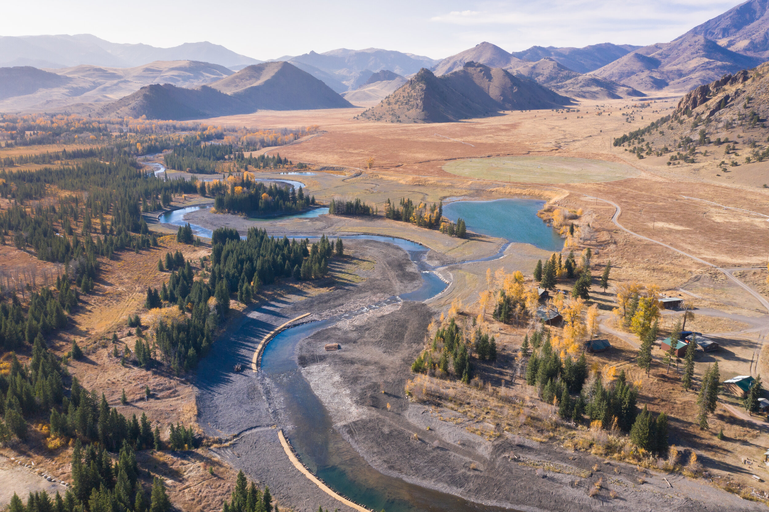
The WaterVation header video features aerial videos from our recent projects. Our team flies every site at set intervals throughout the projects to build a digital progress record. As you can see in the “slider comparison” below, this recurring data collection is used to compare job progress and long-term monitoring.
Aerial Orthomosaic Comparison
Use the slider to compare the pre-construction vs. the completed projects.
Fountain Creek, Colorado (above) | Sunlight Creek, Wyoming (Below)
2D + 3D Rendering
Virtual Flythrough | Geospatial Refrence
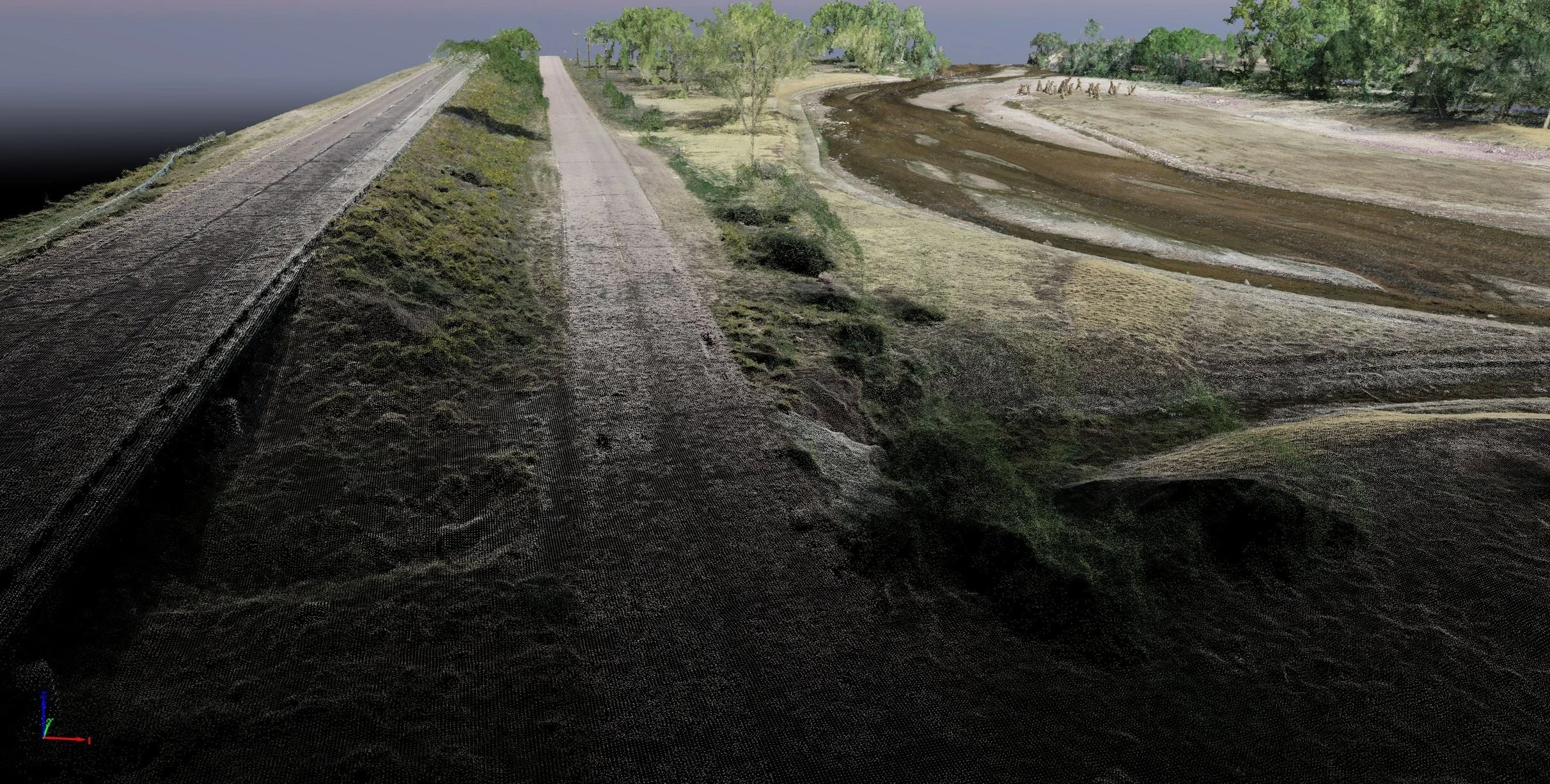
High-density point clouds (.las / .laz) are a valuable dataset for project design and long-term monitoring. The 3D environment allows for 2cm detail on a geo-rectified surface. Combining aerial UAV and terrestrial survey results in a very precise model without the traditional cost of fixed-wing mapping.

Digital Model
DTM | DEM | Vegetation
Visualizing data and providing the base for 2D and 3D designs. Ready for direct import into CAD and most professional geospatial software.
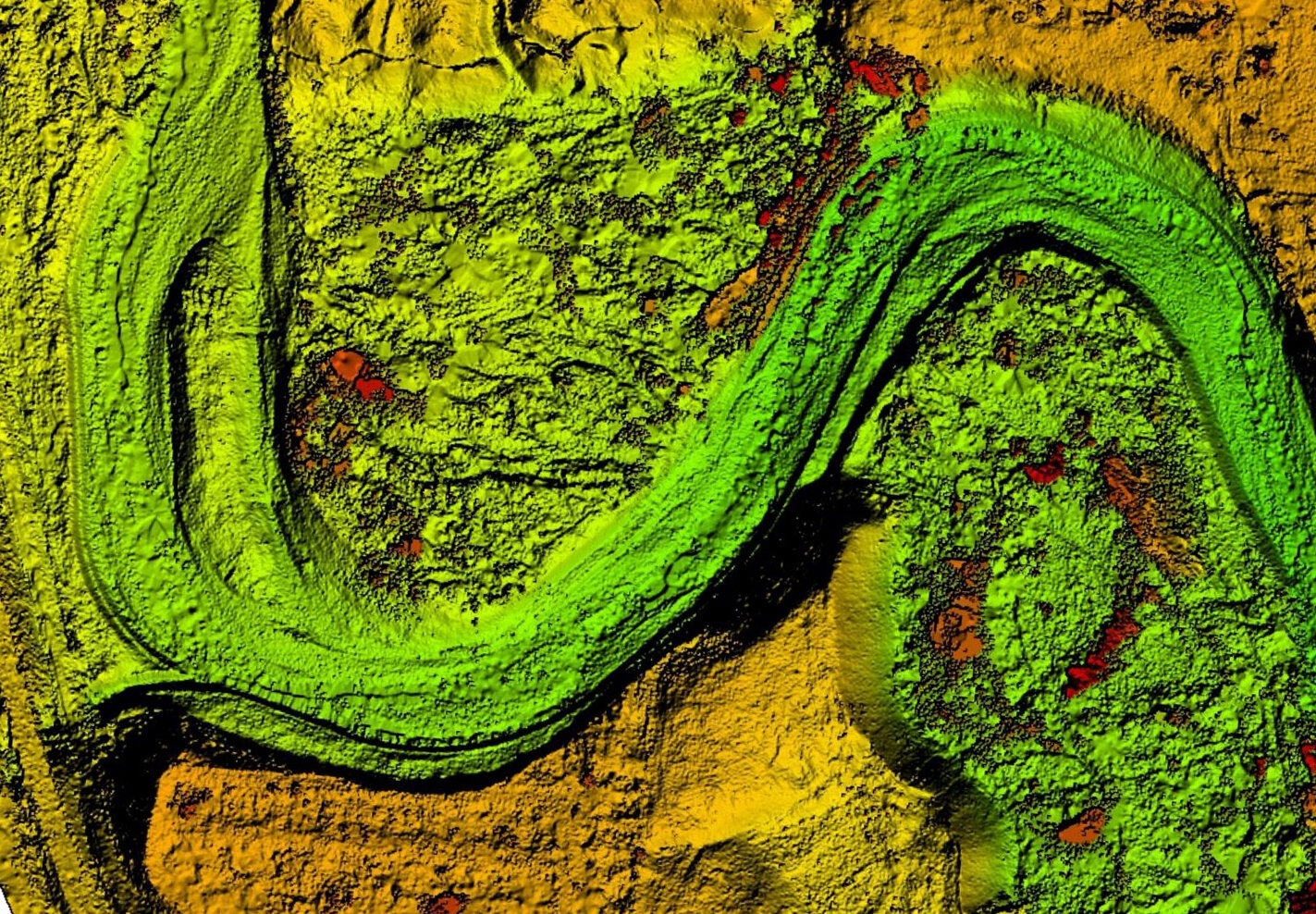
Point Cloud | 3D Terrain Model
By assigning different color palettes to the point cloud we are able to better visualize the data. Point clouds are both a great visual reference, as well as a highly accurate geospatial model. These .las or .laz files can be derived from photogrammetry data collection, as well as by LIDAR collection.


Video Documentation
Monitoring | Assessment | Promotion
4k Video provides a real-world snapshot of a project and the surrounding area. Our assessment and monitoring videos provide an unbias documentation of conditions, project status, or monitoring updates. Videos are often done in intervals and have been a valuable resource to showcase projects.
Professional Photography
Feature your project with professional photography - both aerial (drone) images, and ground-based photography.


WaterVation UAV Services
Our team is always happy to customize data collection to meet the needs of any project. Use the contact form (right) or reach out by email info@water-vation.com.
In addition to standard FAA clearance, WaterVation maintains many active restricted airspace waivers. This enables our team to operate in close proximity to military airspace, as well as in controlled airports.
Sincerely,
The WaterVation Team
